Montana Aerial Photos.gif)
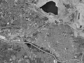 |
| Aerial
Photograph of Butte |
Montana,
as seen from space, is pretty neat. Viewing the mountains,
cities, roads and rivers in Montana from space provides
some wonderful views and provides a completely different
perspective on any given location.
As such,
I decided top put up some aerial photos of various places
in Montana. These aerial photos are all from the USGS and
were created on the Terraserver, which is partially run
by Microsoft.
These
aerial photographs are all public domain images - so you
can use them as you see fit. However, please
do not hotlink these images from bigskyfishing. Instead,
just "right click" and then save the image to your local
computer.
Note,
clicking on any of the links below will bring up the aerial
photograph in a new window.
Aerial Photograph of Montana
Cities
Billings
Aerial Photograph
Bozeman
Aerial Photograph
Butte
Aerial Photograph
Great
Falls
Aerial Photograph
Helena
Aerial Photograph
Kalispell
Aerial Photograph
Whitefish
Aerial Photograph
West
Yellowstone
Aerial Photograph
Other
Montana Aerial Photographs
Big
Mountain Ski Resort Aerial Photo
Montana
Hi-Line Aerial Photographs & Maps : Aerial
photos and maps show the beautiful Hi-Line region of
Montana
Top
of Page
| 
