Montana Hi-Line Maps & Aerial Photos
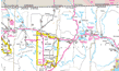
To give visitors to this section who are unfamiliar with the Hi-Line region of Montana, I've put together some maps that show the region. These are just standard state highway maps, cut into three pieces. Additionally, several aerial photographs of the major cities along the Hi-Line are also available for viewing.
Hi-Line Maps
See Google Map of Northern Montana
Hi-Line Aerial Photos
Below are links to Google Maps that show hybrid maps (aerial photos/traffic map combined) of the various cities along the Montana Hi-Line.
Next Page : Future of the Hi-Line Region
Copyright 2002 - 2018 Big Sky Fishing.Com
|
|
|