
The South Fork of the Flathead River is Montana’s crown jewel in terms of remote rivers. The river provides outstanding fishing for native Montana trout in a remote and beautiful setting.
Article Contents
Introduction to the South Fork Flathead River
The South Fork of the Flathead River begins deep in the heart of Bob Marshall Wilderness complex, one of the nations largest designated wilderness areas. Sprawling more than 1.5 million acres, the Bob Marshall Wilderness complex (known to locals as “the Bob”), which also includes the Great Bear Wilderness and the Scapegoat Wilderness, is perhaps the wildest location in the lower 48 states. Grizzly bears, moose, elk and wolves all call the Bob home.
Access to the wilderness complex is excellent, with dozens of trails threading their way from easily accessible trailheads along the perimeter of the wilderness. However, the Bob is not like most other wilderness complexes, which you can simply hike across in a day or two. To simply reach the interior of the Bob frequently requires hikes or horse packs of several days. Once in the interior, a person can spend months traversing the 2000 miles of trails that criss-cross this vast wilderness area.

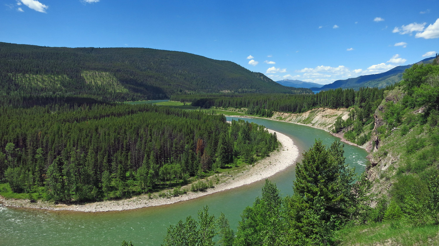
South Fork Flathead River upstream from Hungry Horse Reservoir
Due to the fact that the South Fork of the Flathead River starts deep in the wilderness area and flows for more than 40 miles through the heart of the complex, simply getting to the South Fork is an adventure in itself. Backpacking gear is needed for the angler without a horse to fish the South Fork above the Hungry Horse Reservoir, as the only access to the river is by trail.
The natural elements in the Bob should not be taken lightly. Weather is highly changeable, with summer snows not uncommon. Nighttime temperatures, even during the short summer months, frequently plummet below freezing. This is in addition to the local wildlife that can make any trip an interesting and memorable experience.
Most travelers to the wilderness complex do not come here to fish. The heaviest use in the Bob occurs in the fall, during hunting season. Summer also registers a fair amount of backpacking and horse packing visitors, although a person is unlikely to see more than a couple parties of people once away form the popular day hiking trails on the edge of the wilderness area. The Bob is not a National Park, where a traveler is likely to bump into countless hordes of people wandering its trails. For those who seek it, the Bob is a wonderful place to find solitude, especially in the areas away from the better-known areas such as the Chinese Wall.
After traveling more than 40 miles, the South Fork finally leaves the protected wilderness area, and begins to follow the reservoir roads for another 20 miles until spilling into the Hungry Horse Reservoir. The reservoir is more than 50 miles long, created by the 460-foot Hungry Horse Dam. Below the dam, the South Fork flows for 5 miles before entering the Flathead River just downstream from the town of Hungry Horse.
Fishing the South Fork Flathead River
Fishing Above Hungry Horse Reservoir & in the Bob Marshall Wilderness
The fishing in the South Fork of the Flathead River is, quite simply, excellent above Hungry Horse Reservoir for cutthroat trout, especially the portion of the river that lies in the wilderness area. The reason for that is two fold. First, Montana Fish & Game imposed strict special wilderness limits years ago. The result is that anglers now sometimes struggle to catch fish that are small enough to keep. The second, and somewhat obvious, reason is that in order to reach the river in the wilderness area requires considerable time and energy, as it lies in a very remote setting by any standard.
Of course, this remote setting has its benefits. Fishing pressure is very low in the wilderness area compared to virtually any other Montana river. The trout are all wild—there is no hatchery grown fish here. Since the fishing pressure is low, the trout aren’t horribly picky about what they will take. Pretty much any caddis fly or mayfly imitation in size 10-14 works just fine. Terrestrial patterns, particularly hoppers, also are excellent to use in July and August. Just be careful not to spook the fish—the waters of the South Fork of the Flathead River are crystal clear.
Access to the South Fork is by foot or horseback. Either way, it’s a long way in from any trailhead to reach the river. About the closest you can get to the river by vehicle is by using the long and curvy West Reservoir Road that crosses the Hungry Horse Dam and meanders around Hungry Horse Reservoir. The distance from the Dam to the trailhead at Meadow Creek Pack Bridge is about 50 miles, which takes about two hours. And not a single service will be found, so bring whatever you need, as you won’t be able to buy something if you forget it. The road also has a reputation of being hard on tires, so make sure you have a good full size spare or two.
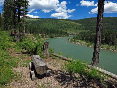
A Seat with a View on the South Fork Flathead River
Upon reaching the Meadow Creek Pack Bridge, it is a short hike into the wilderness. From there, the South Fork trail more or less follows the river throughout its journey in the wilderness area. The catch is, of course, the best fishing is found well above the Meadow Creek Pack Bridge, as far fewer people fish upstream than at the much more accessible trailhead. Fly-fishing can also be quite difficult around Meadow Creek Pack Bridge and upstream for a number of miles since the river is cloaked in dense forest. The river also runs through a deep, nearly impassable gorge for several miles (called Meadow Creek Gorge) just upstream of the pack bridge, thus forcing anglers to go further upstream to fish.
Regardless of where you enter the Bob, the South Fork is a wade fisherman’s dream. Other than the Meadow Creek Gorge area, a wade fisherman can access virtually any segment of this river, spending weeks if not months exploring every pool, run and riffle. While the river is deep in spots, the river should pose no challenges to the alert wade fisherman.
Wade fishing is also the most popular way to fish the South Fork of the Flathead River, simply because getting a raft into the wilderness area is no easy feat. Any rafts will need to be brought in either on your back or on horse. Several guide services located around the Bob provide packing services, and can pack in gear for the floaters without a horse.
Special regulations and limits apply when fishing in the wilderness portion of the South Fork. Only 3 fish of any type (cutthroats, rainbows and grayling all are found in the South Fork) may be taken, none of which may be over 12 inches. Additionally, from Meadow Creek Pack Bridge (near the wilderness area boundary) down to Spotted Bear footbridge, it is all catch and release and only artificial lures may be used.
Hopefully, the catch and release restrictions won’t bother you since you catch and release all fish anyway! However, if you’re not, here’s something else to consider before putting that trout into the frying pan. Any fish you catch while in the wilderness area will have to be eaten there. And cooking fish, especially over an open fire, produces a powerful aroma—an aroma that grizzly bears just love. So the moral of the story is this: If you cook any fish while camped in the wilderness area, make sure you cook them well away from where you’re camping (like hundreds of yards). Dispose of all entrails and uneaten portions far away from where you are camped. Also wash off all pans and utensils thoroughly, and leave them away from camp too. Failure to take these precautions is likely to lead to uninvited and probably unwanted guests with large claws and teeth probing your campsite during the night.
Fishing the South Fork Flathead River Below Hungry Horse Dam
The South Fork only flows for 5 miles below Hungry Horse Dam before the river ends at the confluence of the Flathead River. The fishing in this stretch, however, has a chance to become a much better fishery in the years ahead.
Hungry Horse Dam was modified in the mid 1990’s to allow it to draw water from any depth of the reservoir. This has important implications. Prior to this modification, all water released came from the bottom of the dam – where the water was coldest. This cold water pretty much killed off the fishing in the South Fork below the dam during the summer, and greatly affected the aquatic hatches on the main stem of the Flathead as well. With this modificationt, the dam now releases water that has the same temperature as the Flathead River five miles downstream. With near freezing water no longer flowing through the river during the middle of the summer, insect hatches have improved significantly on both the South Fork and the main stem of the Flathead River. This should lead to significantly better fishing in both the South Fork below the dam and for the Flathead River in the years ahead.
Rafting & Paddling the South Fork Flathead River
Floating the South Fork of the Flathead River is perhaps one of the finest floats anyone can do in the lower 48. The scenery is spectacular, as the river flows through a pristine and remote wilderness. Unlike other wilderness floats (such as on the Middle Fork of the Salmon in Idaho), the river is not over-run by rafting parties, since the only way to put a raft into the South Fork of the Flathead is by packing it in. And the pack in is neither quick nor easy—any pack in requires covering at least 25 miles or more of mountainous terrain.
From it’s beginning near Danaher Creek, the entire South Fork is floatable except during low water. Up until reaching Meadow Creek Gorge 40 miles later, described later, the river presents no special challenges to a rafter. The river meanders its way through some of the most spectacular country a rafter could hope to find. Due to the remote setting and the difficulty and expense of bringing in rafts, the river is relatively free of floaters, allowing for a peaceful, scenic float.
This peaceful and tranquil setting changes when the river reaches Meadow Creek Gorge. As the river flows through this gorge, the river becomes extremely narrow with big drops and sharp turns. To even contemplate going through this gorge will require a very small, tough raft, whitewater inflatable kayak or hard shell kayak, as any large raft is quite likely to get frequently stuck and require countless portages. Numerous Class II, III and IV rapids exist in this gorge.
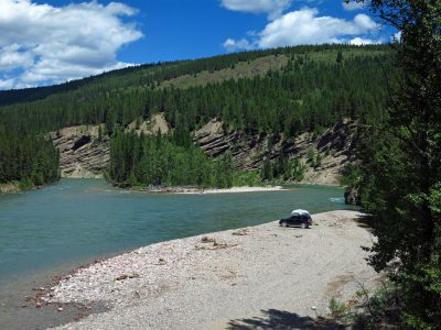
Camped out along the South Fork Flathead River
To avoid going through this gorge, any floater must be prepared to pack out their gear (you just can’t float out to your car). The best place to exit the river is at mile 61.6, which is marked by a small sign. From the take out point, it is a three-mile walk to the Meadow Creek Trailhead.
Below Meadow Creek Trailhead, the floater who wants to continue down the river to Hungry Horse Reservoir can put in their boat at an unofficial access point called Cedar Flats. This is about 2 miles south of the Trailhead, and requires a short walk to the river. From this point, you can float another 18 scenic miles to Hungry Horse Reservoir.
Below the dam, the river only runs for 5 miles. There is one rapid section below the dam called Devils Elbow, with two short Class IV rapids. To reach this section of the river, though, requires going down a rather steep and hazardous put-in at the dam.
South Fork Flathead River : River Miles
- Danaher Creek (origin) :100
- Big Prairie Ranger Station Pack Bridge: 92
- White River Confluence: 83
- Black Bear Ranger Station Pack Bridge: 69.5
- Picture Creek: 64.1
- Takeout to avoid Meadow Creek Gorge: 61.6
- Meadow Creek Pack Bridge: 58.9
- Cedar Flats (take in point): 57.1
- Spotted Bear River: 48.4
- East-West Bridge: 46
- Log Landing (take out point before Reservoir): 40
Photographs of the South Fork Flathead River


Related Articles on Big Sky Fishing.Com
- Hungry Horse Reservoir – Fishing & floating information
- Flathead River – Fishing & floating information