|
|
| River Fishing | Lakes | Mountains | National Parks | Explore Montana | Outdoor Gear | Books |
| Explore Montana > Montana Scenic Drives > Gravelly Range Road Backcountry Drive > Page 2 | Search Site |
|
The Gravelly Range Road Backcountry Drive, Page 2
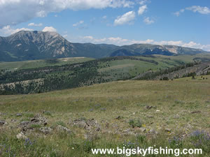
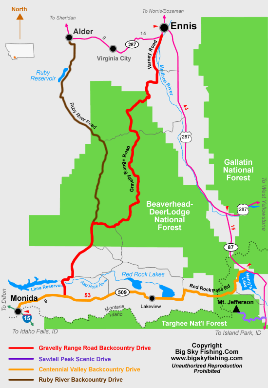
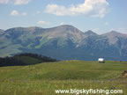
Beginning two miles west of Ennis on Highway 287, the Gravelly Range Backcountry Drive initially follows Varney Road, which is paved. Varney Road parallels the Madison River for nine miles, passing by several fishing access sites, to Varney Bridge. Beyond Varney Bridge, the pavement ends as the road turns to an all-season gravel surface. A few miles beyond Varney Bridge, be sure to go left at the Hatchery cut-off. The road that goes to the right is a dead-end road called Fish Hatchery Road. The route reaches the Gallatin National Forest after about seventeen miles, and soon begins to climb into the mountains, passing through a mix of open grass and scattered forest. After twenty miles, the road reaches the junction with Gravelly Range Road. Follow this road to the left. The Gravelly Range Road wastes little time gaining elevation and soon begins a very steep and rather twisty ascent up the side of the Gravelly Range. After a few miles, though, the road emerges onto the plateau. Once on the plateau, the road starts to meander across the rolling terrain, through a mosaic of beautiful meadows, slowly gaining elevation as it heads toward Black Butte Mountain and Monument Ridge.
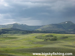
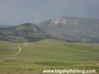
After about twenty-eight miles, the Gravelly Range Road reaches a junction with FR 324. Stay on Gravelly Range Road, since FR 324 leads back down into the Madison Valley. The Gravelly Range Road reaches its highest elevation of the drive, 9587 feet, at Monument Ridge. Black Butte Mountain, with an elevation of 10,545 feet, rises just to the south. Beyond Monument Ridge, the Gravelly Range Road starts losing elevation as it makes a semi-circle around Black Butte Mountain. Travelers who won’t be taking the entire drive down to the Centennial Valley should none-the-less follow the road a few miles beyond Monument Ridge, as the views from the south of Black Butte Mountain are quite beautiful and rather unique. After forty miles, the Gravelly Range Road reaches the junction with FR 237. FR 237, via a roundabout way, leads back to Highway 287 and can be used to create a “loop trip” back to Ennis. As I have not driven this road, I’m unsure of the condition of the road. After forty-nine miles, go right at West Fork Station. The Gravelly Range Road officially ends after about sixty miles, at the junction with FR 100 (which is part of the Ruby River Road Backcountry Drive). To follow the Ruby River Road Backcountry Drive, go right (north). To continue following the Gravelly Range Road Backcountry Drive, go left toward the Centennial Valley. A few miles later, the Gravelly Range Road Backcountry Drive leaves the National Forest and enters Bureau of Land Management land. This short section of the drive can have some nasty road conditions, and even when the road is dry a high-clearance vehicle can come in handy to navigate around the ruts and occasional puddles that form in the road. Beyond that rough patch, the condition of the road improves dramatically as the route enters the Centennial Valley and starts to follow the Centennial Divide Road. The Gravelly Range Road Backcountry Drive ends at the junction with Highway 509, which is part of the Centennial Valley Backcountry Drive. From this junction, Monida and Interstate 15 are nine miles to the west. Travelers can also go left (east) at this junction to head across Red Rock Pass and toward Henrys Lake. Overall, the Gravelly Range Road Backcountry Drives is one of the most spectacular scenic drives in Montana. While a trip down this road does require a commitment of time, the beautiful views of mountain meadows and towering mountain peaks will make the time spent on the drive very worthwhile. Quick Facts
Return to First Page of Article
|
| Montana Web Cams | Contact | Privacy Statement | About | Photo Use Policy | Advertising Info |