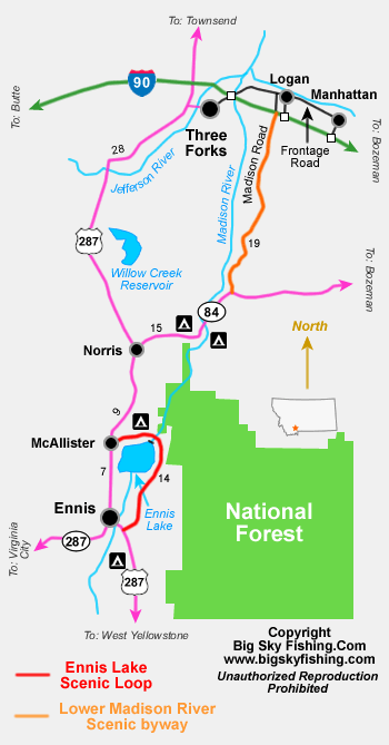
The Ennis Lake Scenic Loop
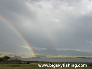
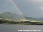
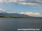
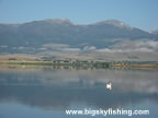
The Ennis Lake Scenic Loop is a short, twenty-three mile fun little drive that, as the name suggests, makes a loop around the scenic Ennis Lake. Highlights of the drive include scenic views of Ennis Lake, the Tobacco Root Mountains, the dam on Ennis Lake and the mountains of the Madison Range.
The drive follows three roads to complete the route: the North Ennis Lake Road, which begins in McAllister, the Ennis Lake Road, which follows the eastern shore of the lake, and Highway 287, which runs between Ennis and McAllister.
Beginning in Ennis, the drive heads north along US 287 for seven miles, to McAllister. In McAllister, the route turns east on North Ennis Lake Road. In the event you can’t find the markings for this road, instead just look for the sign that points to the Ennis Lake Fishing Access Site. As is customary for Montana, road names themselves are not often marked well, but the fishing access sites always are.
After two miles, the route passes the Ennis Lake Fishing Access Site, which also has a small and often crowded campground.
Beyond the fishing access site, the route closely follows the northern shore of Ennis Lake. Many pull over spots exist right on the lake, allowing for easy fishing access or photography locations.
After a few more miles, the Ennis Lake Scenic Loop crosses over the dam at the head of Ennis Lake. The Madison River flows beyond the dam and begins its journey through Beartrap Canyon. Some excellent fishing can be found just below the dam, along the road that follows the river for a short distance.
Beyond the dam, the road changes names – to Ennis Lake Road – and the route follows this road back toward Highway 287. This section of the drive provides excellent views of the Tobacco Root Mountains and some not frequently seen views of the Madison Valley. The route reaches the junction with Highway 287 just a mile south of Ennis.
Overall, the Ennis Lake Scenic Loop is a fun and simple drive that anyone passing down US Highway 287 should do. The trip takes less than an hour and provides some scenic views that can’t be seen from the main highway.
Quick Facts
- Length: 23 miles
- Highlights : Ennis Lake, Madison River, Beartrap Canyon, Madison Range, Madison Valley
- Road Type : Paved and gravel.
- Nearby Towns : Ennis, McAllister
- 4wd needed? : No
- Traffic : Light to Moderate
- Trailers? : Yes
- Season : Year-round, weather permitting
Map of the Ennis Lake Scenic Loop
The map below shows the route and location of the Ennis Lake Scenic Loop, near Ennis, Montana.
|
Where to Stay & Other Services
There are no services along the scenic drive, although food and gas can be picked up in McAllister. Ennis, though, is the best place to get services and supplies. Ennis also has a few small motels. Bozeman is relatively nearby and offers many more lodging options.
A developed campground is on Ennis Lake at the Ennis Lake Fishing Access Site, just outside of McAllister. There are no primitive camping options directly along the route.
|
Related Articles & Information
|
|