Photographs of Fort Peck Lake & Dam
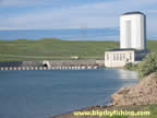
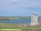
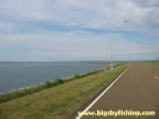
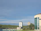
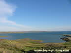
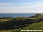
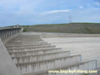
Fort Peck Lake is located 20 miles south of Glasgow, Montana. The lake was created by the construction of Fort Peck Dam, which was completed in 1940. Fort Peck Lake itself is more than 120 miles long and is the largest lake in Montana.
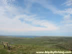
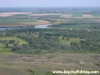
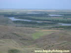
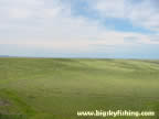
Shown below are some pictures of Fort Peck Lake, Fort Peck Dam and the surrounding countryside. Included are some photographs taken from "signal point", a hill that is about 2 miles from the dam. Lewis and Clark climbed up this hill on their expedition in order to get a better view of the surrounding terrain. "Signal Point" is also known as the "Milk River Overlook" as the hill provides a fine view of where the Milk River empties into the Missouri River.
Visit the page about Fort Peck Lake for more information about the lake and Fort Peck Dam.
Photo Use Policy : Please read the
photo use policy
if you would like to use any of these photos for online or offline use.
Fort Peck Lake & Dam Pictures
Previous Page : Fort Peck Lake & Dam
Copyright 2002 - 2018 Big Sky Fishing.Com
|
|
|