Montana has no shortage of rivers. And where there are rivers, there are maps. And happily for anglers visiting Montana on a fishing or recreational floating trip, there are many river maps available to provide in-depth information about many of the popular rivers.
Currently, three different types of river maps are available that show in detail all, or parts, of specific rivers in Montana. Since these river maps have been designed for both anglers and recreational floaters, the maps show the locations of fishing access sites, other access points, rapids, camping areas, and much more. What differentiates the maps is how they present that information, additional information they show (such as GPS coordinates), the paper quality used and the overall look/feel of the map.
In short, there's no "one right map." Get the map that seems like it should work best for your needs. In terms of cost, maps vary in cost from $6 to $15 per map, depending on map type and where the map is purchased.
The three different river maps available for Montana are:
Montana Afloat River Maps
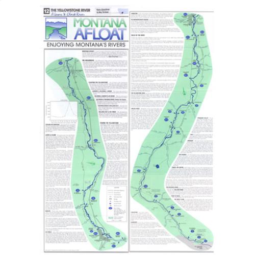
The first river maps for Montana, to the best of my knowledge, were produced first by Montana Afloat. (View Example of Map)
Information shown on each map includes: islands, tributaries, fishing access points, water hazards, campgrounds, river miles and more.
The Montana Afloat river maps are also extremely durable, being printed on the type of paper that doesn’t fall apart when it gets wet. They are also very easy to fold.
Some of the larger rivers, such as the Yellowstone, have two distinct maps (the Upper and Mid maps).
Montana Afloat Maps are available for virtually all of the popular rivers in Montana, and provide coverage for some rivers that the two other map types available lack (such as the Middle Fork and North Fork Flathead River).
Whre to Buy Montana Afloat River Maps
One of the problems with Montana Afloat Maps is that they are not widely available. Most fly shops in Montana do carry some of these maps. However, few fly shops carry all of them or have them in stock at all times. Still, if you happen to be in Montana and have a use for these maps, do hunt around for them in the local fly shops. With some luck, perhaps the fly shop will have the exact map you need.
The more guaranteed way to make sure you have the map you need is to order it online. Oddly, the most logical place many would think would carry these maps – Amazon – doesn’t stock them. Nor do some of the popular outdoor fishing related retailers, such as Cabela’s or Orvis.
Fortunately, a number of Montana and smaller out-state fly shops do carry these maps. I’ve located these maps online at the following fly shops/outdoor goods related dealers:
- The Rivers Edge
- Worley Bugger (more expensive here)
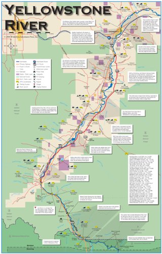
Wilderness Press Adventures Maps
Wilderness Press Maps cover most, but not all, of the rivers that Montana Afloat Maps do. However, their maps also cover a few bodies of water that Montana Afloat does not, such as Georgetown Lake
These maps also provide more information than Montana Afloat maps do. They also are a bit better organized, with a cleaner look. I personally prefer these maps, as I find them a easier to read, contain more helpful information for my particular uses, and are more visually pleasing. They are equally as durable as the Montana Afloat maps are, too. (View Example of Map)
The maps also show public land information, which is extremely helpful.
Their maps provide the following information:
- GPS coordinates for every access point, boat ramp, many bridges, and more
- All public land is shown (this is good. Other river maps don't provide this)
- River miles are shown for floating distances
- River description
- Hatch chart, Recommended flies
These maps, which are available through Amazon, cost around $10. Some stores in Montana, particularly sporting good stores, also sell them - although they rarely have the "complete assortment" like Amazon does.
Buy these maps & get more information at Amazon
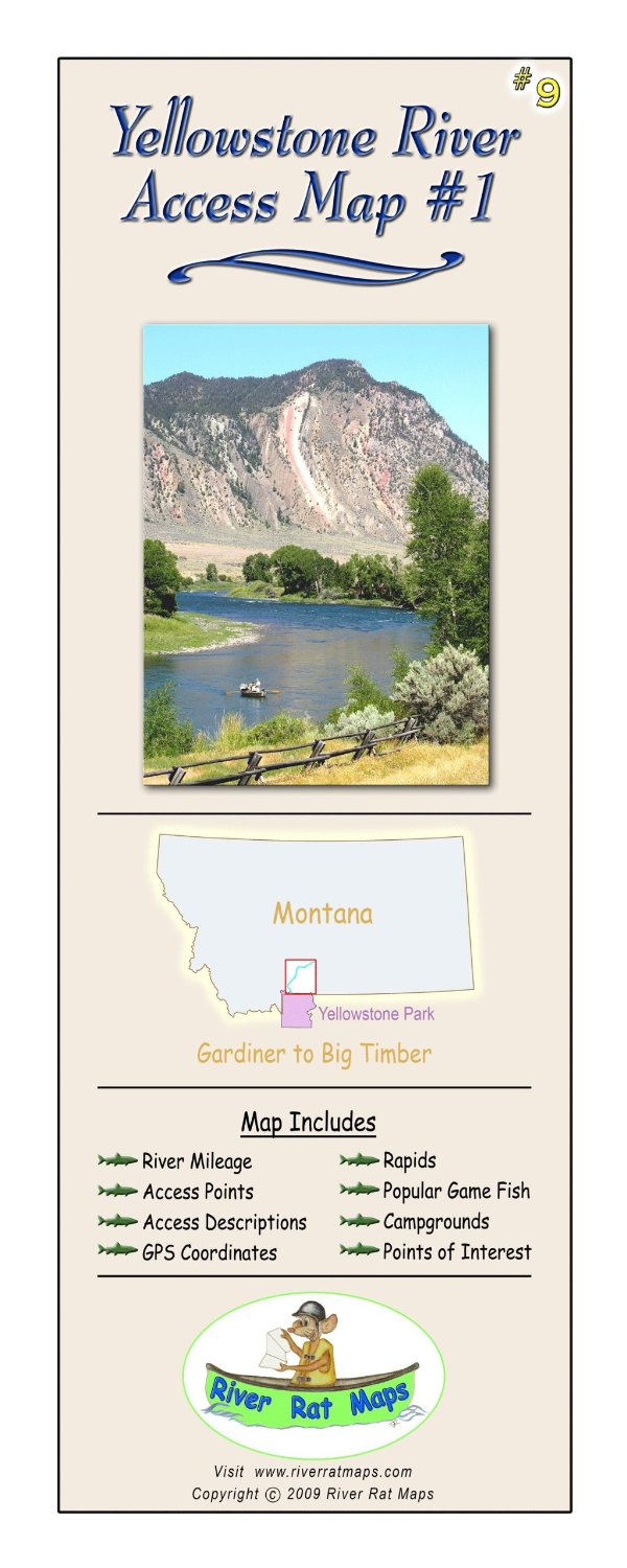
River Rat Maps
River Rat maps are a comprably new map type, as I didn't discover them until 2013. They are the most expensive of the maps available, costing around $15 or so each. However, they also have the most detail. (View Example of Map)
Maps are available for many of the more popular floating and fishing rivers in Montana, although their maps do seem to focus more on the rivers of Southwest Montana (Rock Creek, Bitterroot River, etc...).
Availability of these maps seem rather limited. The only place I've found them is on the Amazon website, although some fly shops or sporting good stores in Montana are bound stock at least a few of them.
As an Amazon Associate this site earns from qualifying purchases.