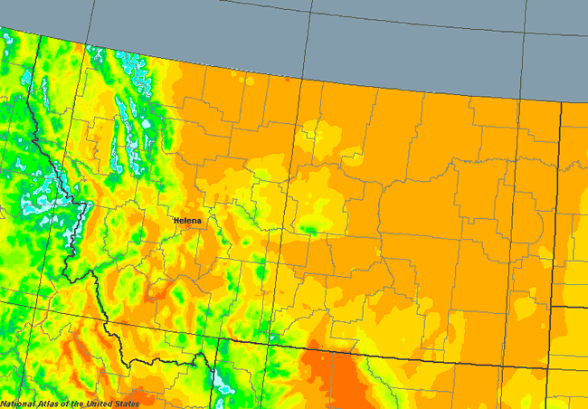
This map is very illustrative of how dry Montana is. As you can see, much of central and eastern Montana is very dry, receiving less than 15 inches of annual precipitation a year. As the precipitation map shows, the heaviest precipitation in Montana is found either on the higher mountain peaks or up in NW Montana. Notice the huge amounts of precipitation found in the Glacier National Park area, which is highlighted in a light blue. In the higher peaks of Glacier, it is not uncommon to have more than 60 inches of annual precipitation a year (most of which falls in the form of snow). Conversely, just a few miles away to the east in Glacier, it is also not uncommon for the landscape to be significantly dryer (the high mountains rob the surrounding areas of moisture). |