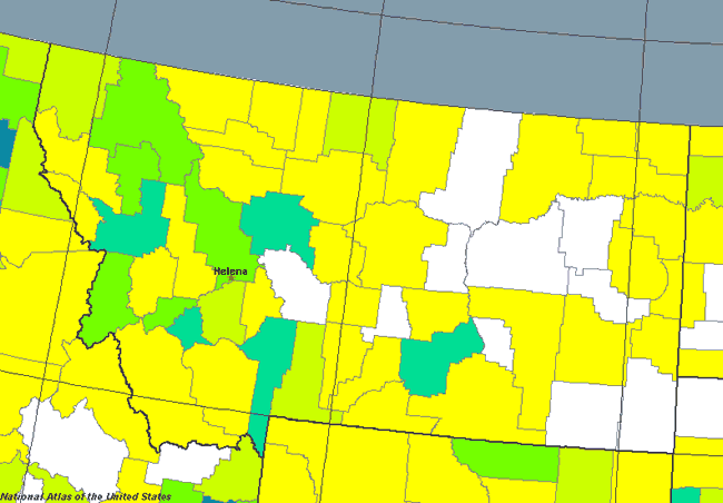
As most people know, Montana is not heavily populated, and this population map for Montana shows just that. The Montana population map is based on the 2000 census, so things have changed just a little bit since then, but the map still primarily holds true today. As you can see, eastern Montana is VERY thin on population - and is, in fact, continuing to lose what population it does have. Some of the counties in eastern Montana even qualify for the dubious label of "frontier counties", which have less than 2 people per square mile living there. While the prairie area of Montana continues to lose population, the western part of Montana, where the mouuntains are, continues to gain it. With the exception of Billings, all of the most populated areas in Montana are either in the mountains or right on their edge (like Great Falls is). |