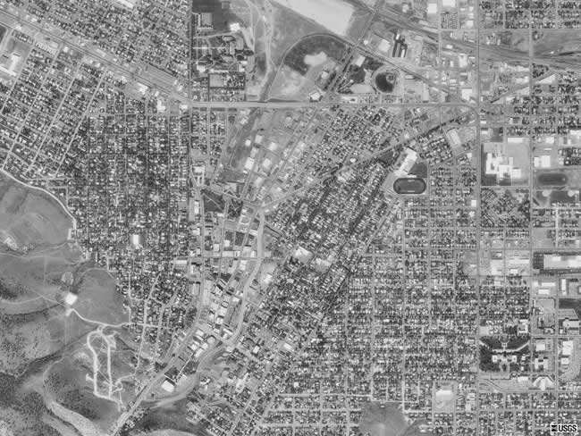
This aerial photo is a close up view of Helena, Montana. Helena, in case you don't know, is the state capitol of Montana. The capitol building itself is located in the bottom right corner area of the aerial photograph (where all the dark green is with a white building in the middle). In this aerial photograph, the area on the bottom left corner area is Mt. Helena city park. The area to the right of Mt. Helena city park is the Last Chance Gulch Area - which is the downtown heart of Helena. |