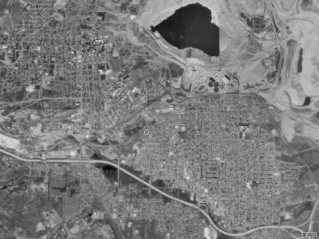
This is an aerial photograph, taken from space, of Butte, MT. Interstate 90 is easily seen makings its way from left to right across the bottom part of the photo. The junction with Interstate 15 can also be seen in the bottom right corner. The "big lake" seen in the aerial photograph is actually the Berkeley Pitt, an abandoned strip mine that is filling up with polluted water. The barren area around the "lake" is other areas in Butte that have been strip mined in the past or are currently being actively mined. |